Tag Archives: roman

St. James’ Way and the ancient road system

The recent proliferation of the so called “Camino de Santiago” (St. James’ Way), although it has its merits, is creating a distorted vision of the ancient road system by tracing indiscriminate routes all over the country without a secure historical basis. Some care in the elaboration of these routes is thus required in order to reflect the true reality of the ancient paths, instead of trying to “force” a route that is hovering here and there, vaguely in the direction of Santiago, and that in most cases has nothing to do with the ancient roads that served this pillgrimage.

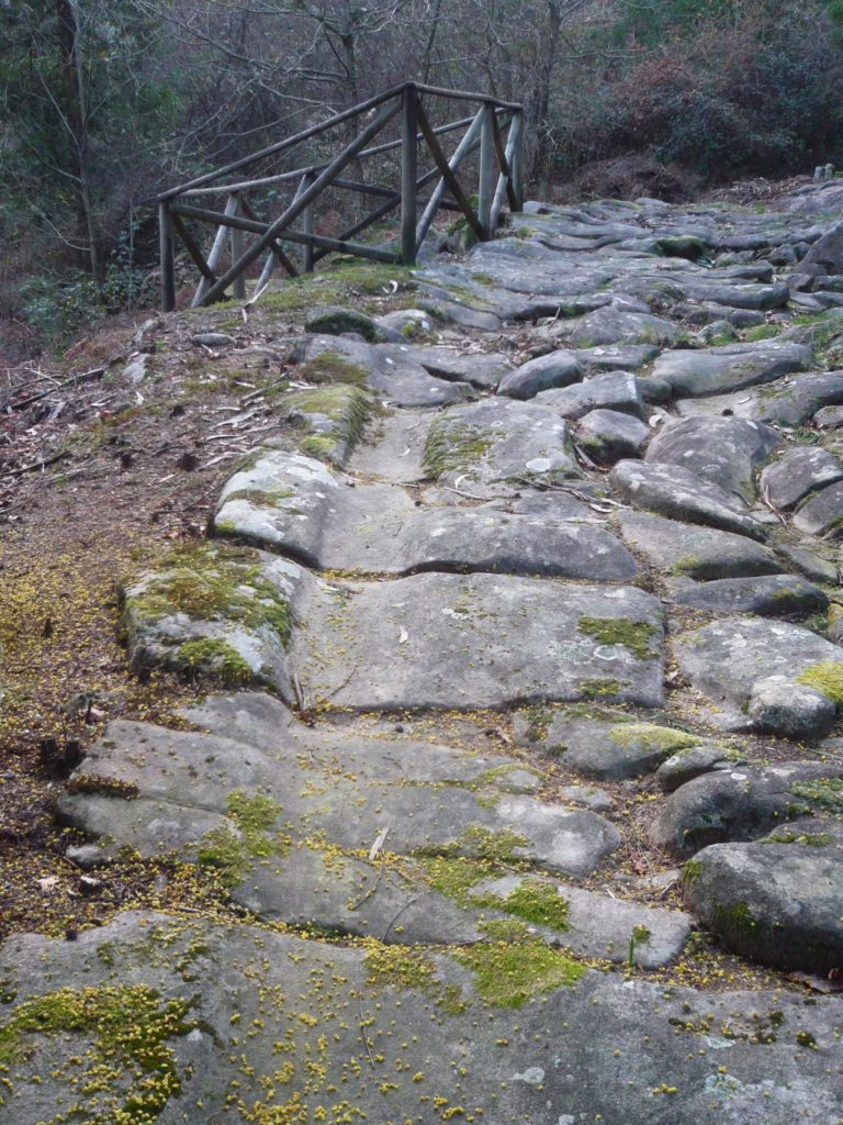
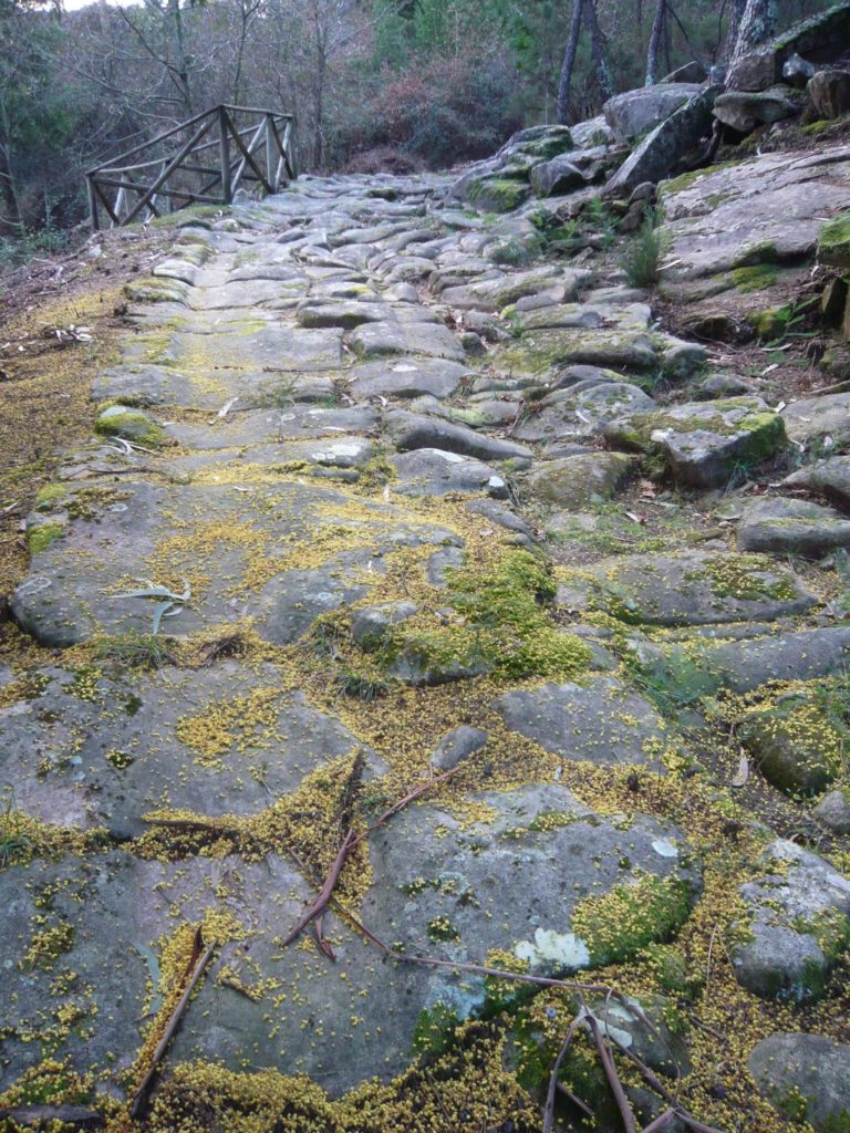
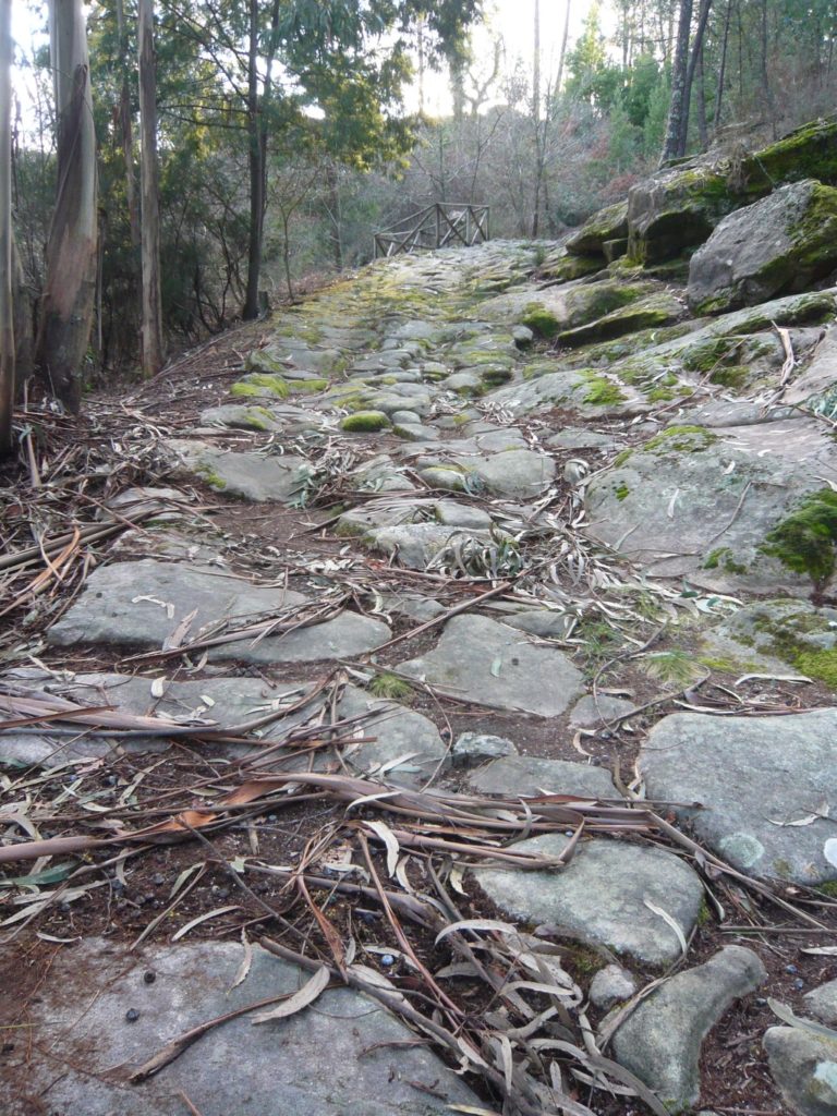
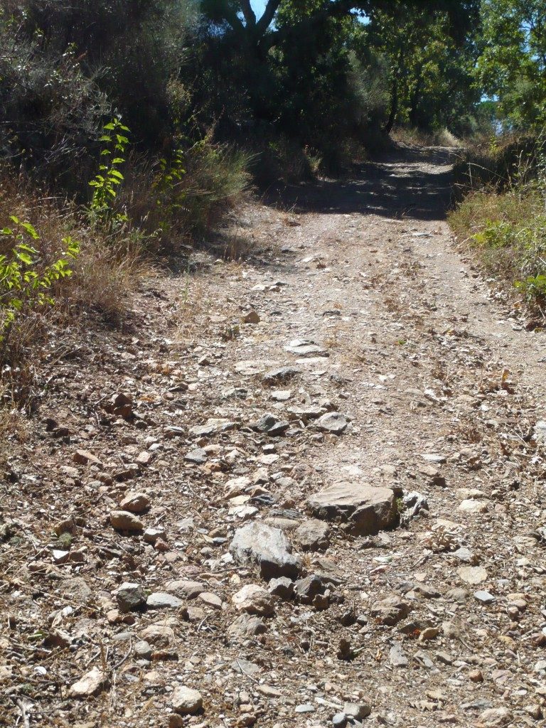
Of course, one can start from any geographical point and go to Santiago, but that does not mean that the path was used for that purpose. The route used by the pilgrims would certainly be the ancient routes inherited from the Roman period (but in reality with much older origins…), and apart from a few minor variations introduced over time, these routes remained practically unchanged until the 19th century, when it was necessary to build a new road network better adapted to motorised traffic.

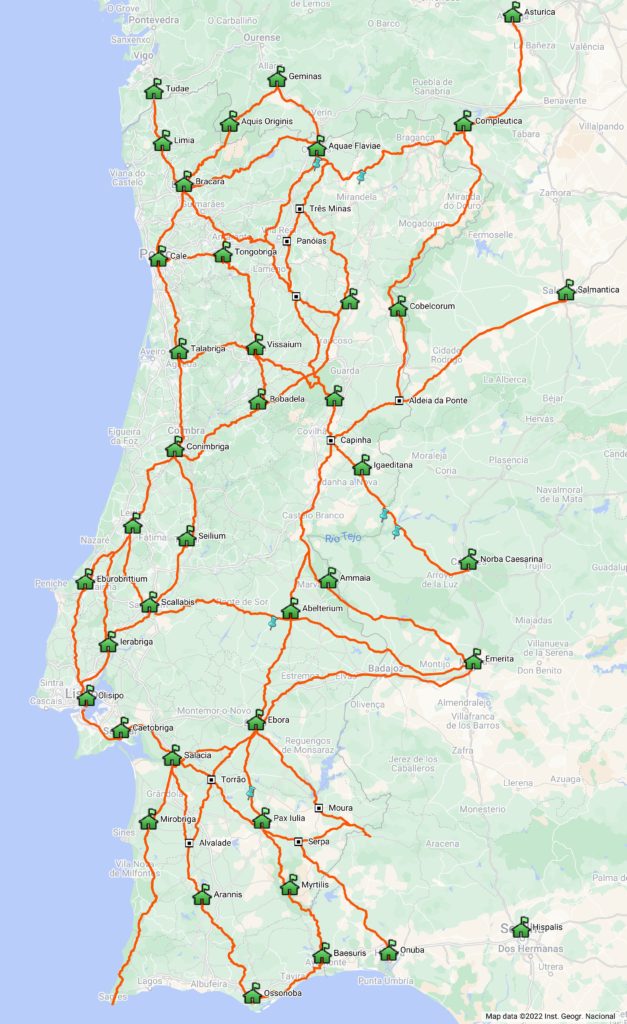
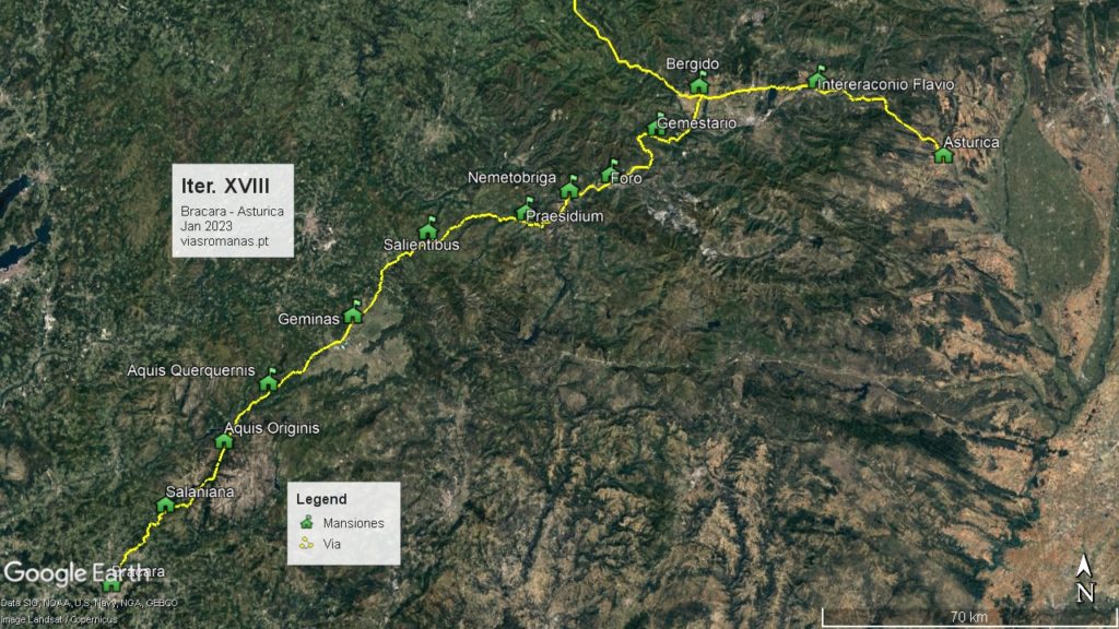
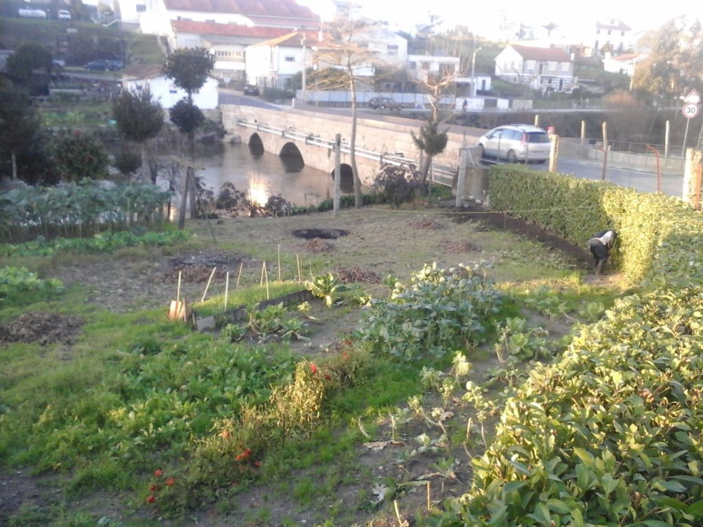
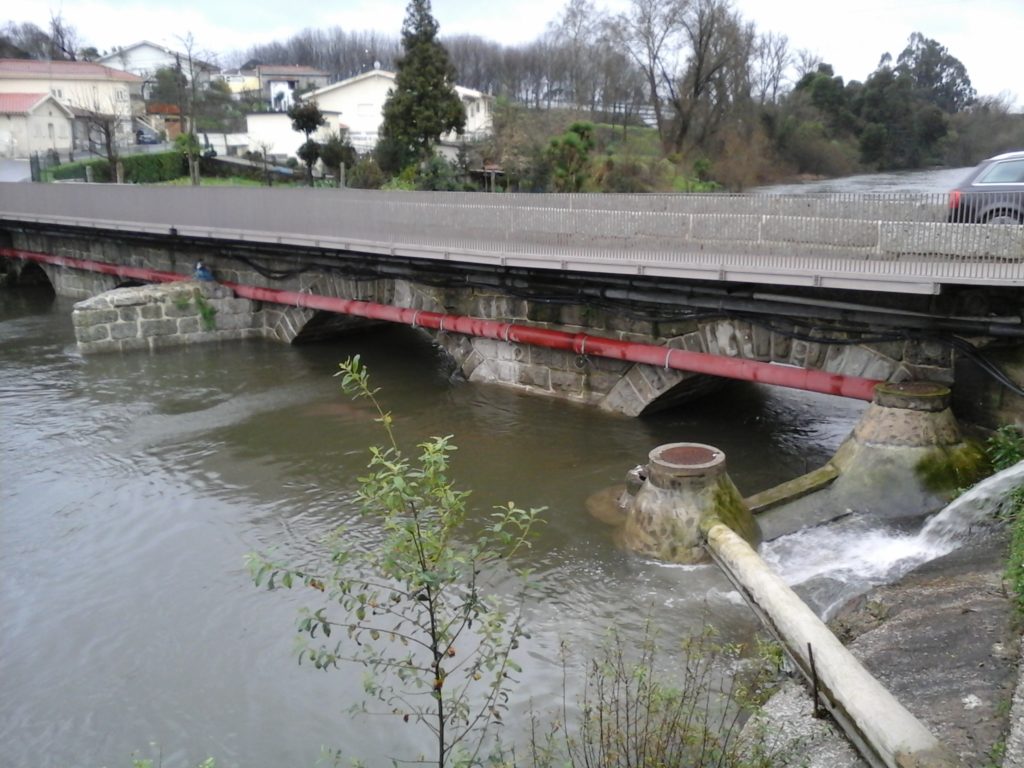
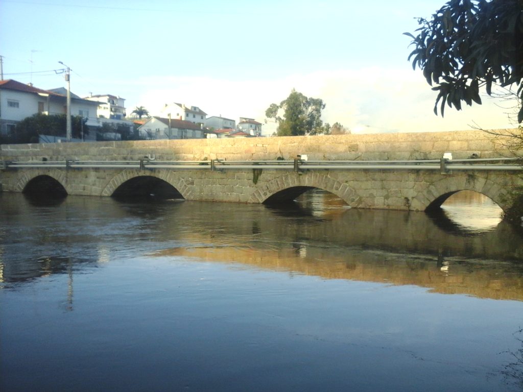
Now, for those departing from the current Portuguese territory, the two main access gates to Santiago would be Tui and Chaves. The first corresponds to the great S-N route from Lisbon which, like today, runs parallel to the coast passing through Santarém, Tomar, Coimbra and Porto, and then continues along the so-called “Central Way” via Barcelos to Valença. Naturally, for those coming from the Beiras region, the most direct route would be via Braga, continuing along the Bracara-Tudae road to Valença. This route aggregated various routes that crossed the River Douro respectively in Porto Antigo, Caldas de Aregos and Régua. From this last place, a route to Chaves run through the Sanctuary of Panóias and reached Chaves by crossing the heights of the Padrela Mountain, where it received another route also coming from another important crossing of the Douro River in Numão (Vesuvio/Ns. da Ribeira) that came through Carlão and Alto do Pópulo until it joined the Régua-Chaves axis near the important Roman mining exploitation of Trêsminas. From Chaves, the pilgrims would enter Galicia, heading towards Torre de Sandiás (Ourense), the station of Geminas mentioned in the XVIII Itinerary from Bracara to Asturica, an axis which crossed at this point, continuing from here to Santiago.

The prevalence of these ancient routes throughout the Middle Ages and even in much later periods makes it impossible to imagine that the route followed a “medieval route” to Santiago different from the one used in the Roman period, although here and there some variants have been introduced over the centuries. In this way, the map we present ends up being a panorama of the routes available for those who were heading to Santiago, which from any point quickly entered this ancient network of roads that practically covered whole the current Portuguese territory.

Milestone converted into Alminhas (shrine) near the Church of Ns. de Cervães (Mangualde)

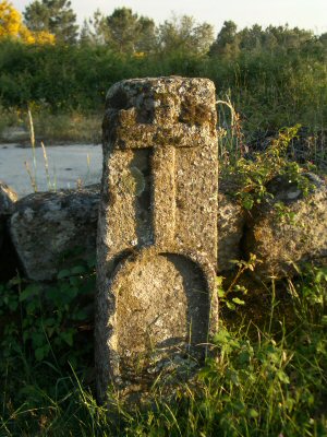
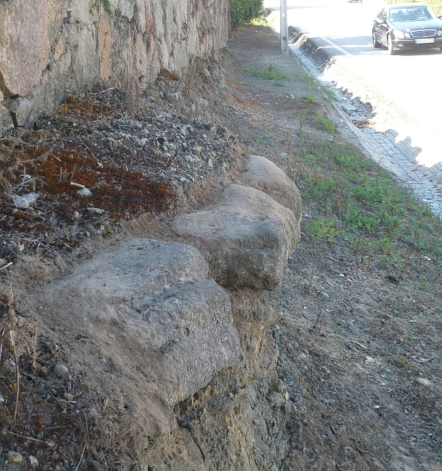
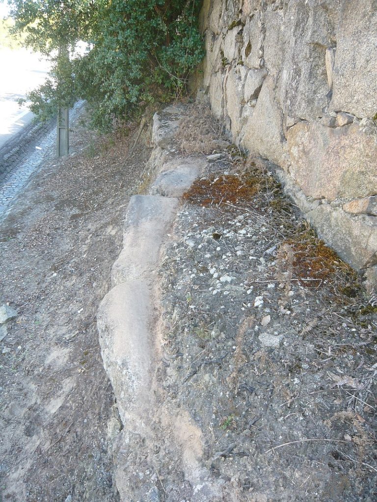
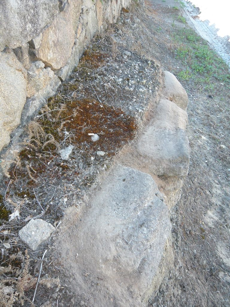
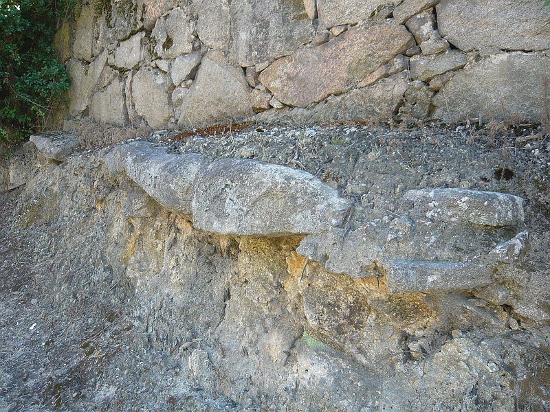
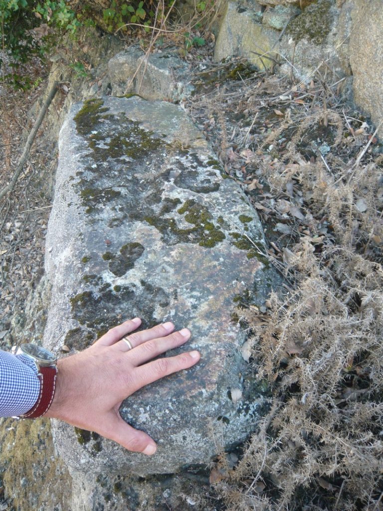
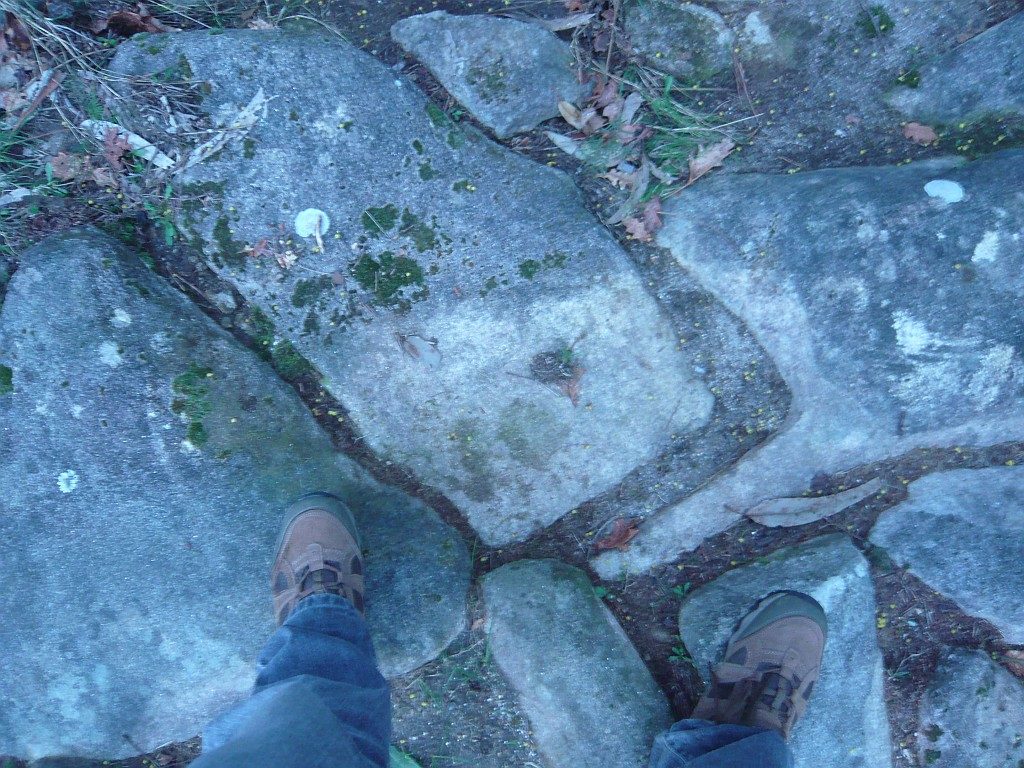
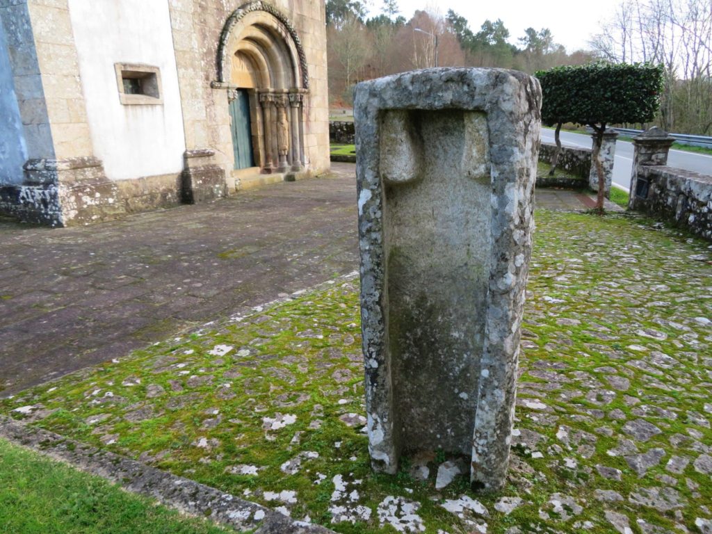
The result is that although we are talking about different periods in time, the Roman and medieval roads are essentially the same physical reality. This can be seen as we travel along these roads because the great majority of the shrines, hermitages, crosses and landstones of the medieval period marking the passage of the way are positioned in accordance with the Roman mile of about 1500 m. In other words, even on the stretches where there are no milestones, it is possible to follow this marking every thousand steps which accompany the pilgrim along the route.

Milestone of Augustus on the courtyard of the Romanesque church of Rubiães, converted into a sarcophagus.

The historical density and typology of these routes has nothing to do with this multiplicity of routes that have been created towards Santiago, distorting the historical reality, taking the pilgrim away from the true immersive experience that these historical routes provide.

February 2023

What’s a “roman road” afterall?

When we started this project in 2004, the idea was to compile the available knowledge about Roman roads in Portugal and make it accessible to everyone. Now, the best way to do that would be to publish online travel routes covering these routes, following the initial spirit of the so-called “Itinerary of Antoninus”, an essential document for the identification of Roman routes, even because at the time there was practically nothing online on the subject.

It quickly became clear that the study of the Roman road network remained buried in a mire of conjecture and great doubts not only about the route followed by the road as well as the location of the stations mentioned in the Itinerary, which actually take us to a pre-Roman reality, a fact evidenced by the large number of indigenous toponyms listed in the document as road stations (the vast majority), and in all cases we can associate then with Iron Age settlements, commonly called “castros”.

Most likely the document has its origins in the military conquest and subsequent civil wars, ending up fixing the main routes that interconnected the strategic centres, but essentially using the same routes of the Iron Age. The aim was naturally to keep control over the traffic circulating along those axes, but above all, a way to control the access to the enormous metalliferous wealth that characterises the Iberian Peninsula, whose economic value would have been the main factor behind the Roman conquest.

The following development is thus in part the continuity of that pre-Roman reality, reflecting the settlement model adopted during the Iron Age, characterised by the installation of settlements near the road axes, forcing the fortification of these settlements with thick walls, as opposed to the previous period, the Bronze Age, where preference was given to settlements on mountain peaks, far from the road and protected from potential enemies, thus dispensing with the construction of a walled enclosure. It is obviously a general framework with several exceptions.

Consequently, the so-called “Roman road” is invariably based on ancient routes of the Iron Age, but receiving many upgrades that provided a better transitability that never existed before. Thus, it would be more correct to speak of “ancient roads” than “Roman roads” since it was not exactly the Romans who designed and built the road. On the other hand, the Roman geo-strategic vision was one of maximum economic exploitation and what mattered was to ensure that the Imperial power had control of the main mining exploitations.

This is also reflected in the epigraphy related to the exploitations of Las Medulas (Ponferrada, León) and Tresminas (Vila Pouca de Aguiar), attesting in both cases a direct administrtion by the Imperial power. In fact, the strong investment carried out in the roads that departed from Braga throughout the Imperial period is the reflex of this need to control this vast mining region that extends until Asturica (today Astorga), fact that is reflected in the great number of milestones of different emperors registered in these roads that connected the heads of the convents Lucencis (Lugo), Bracarensis (Braga) and Asturicensis (Astorga).

Apart from these roads, which are exceptional even in the Roman context, all the others have only a few milestones, much more spaced, marking important points of the route, namely road stations. The existence of remains of structures attributable to the Roman period in these locations indicate the presence of a road establishment to support travelers. This more spaced marking compared to the northwestern peninsular routes is reflected in the smaller number of known milestones south of the Douro. For example, in the Algarve, one of the most “Romanised” regions of the country, only one milestone is known, and even this one has singular characteristics that set it apart from the others found in Portugal.

The other relevant aspect in the interpretation of the itineraries is that it is not a compilation of routes as it has been claimed (in fact, the designation “Vias” was applied in one of the medieval copies, as well as the numbering), but instead these are itineraries, interconnecting the maximum number of relevant points, providing the travellers with a summary of the main routes and the respective intermediate distances. Thus when it is said that there were three ways to Merida, one through Évora, another one through Alter do Chão and another one closer to the Tagus (the so called Via XII, XIV and XV, respectively), we don’t really have three ways to Merida, but three different itineraries, which use independent stretches of roads, forming a great route.

In fact, everything indicates that the main route would be the variant through Alter do Chão, both because it is the shortest route and because it has received several improvements, including the construction of major engineering works such as the Roman bridge of Vila Formosa. Thus, everything indicates that this would be the great route that linked Mérida to the Tejo River, forming a route with caput viae in Santarém and Mérida.

The choice of Mérida for capital of the Lusitânia is surely related with the crossing here of the Guadiana, being therefore this way that allowed the shortest connection of Mérida to the sea, linking this crossing of the Guadiana to the mouth of the Tejo River.

The foundation of Portugal as independent nation and the consequent border disputes with the Kingdom of Spain eventually dictated the slowing down of some of the great trade routes of antiquity, but apart from these forced changes, the Roman road network remained in use for centuries to come and contrary to what has been said it did not completely disappear from the landscape (following the old myth that all Roman roads were paved), but remains in use now as municipal roads or agricultural paths, despite the attacks it has suffered during the last century.

On the contrary, what we see on the ground is a great resilience of these millenary paths, whether they are transformed into modern roads or as almost imperceptible paths on the top of the mountains. Their natural, patrimonial and historical value will eventually come to the surface, which will induce a rehabilitation of these paths, creating an alternative future for these paths that can take them out of the current oblivion.

Map of the main Roman roads in Portugal and respective stations (@pedro.soutinho)

The Bracara-Asturica Itinerary through «Gerês»

This itinerary from Braga to Astorga (Via XVIII of the Itinerary of Antonino) integrates one of the best preserved stretches of the route in Portugal, crossing the Serra do Gerês (where it is called “Geira”), heading towards Galicia through Portela do Homem. The Portuguese part is relatively well studied, with a consolidated route based on the great number of existing milestones, but in the Spanish part there are still great uncertainties, both in the actual route chosen and the location of the intermediate stations. In the attempt to clarify the route to Astorga, and applying the methods developed for the survey of the Portuguese part, we propose the following solution.

Tracing of the XVIII itinerary of Antonino with the respective stopping stations.

The problem is centred in the distances between stages that do not match the distance measured on the ground. Summing all the stages we get 218 miles, however the total distance indicated in the itinerary is 215 miles, a divergence never fully explained and which opens the possibility of errors in the miles indicated in one or more stages. If for Aquis Originis and Aquis Querquennis there seems to be no doubt in their location respectively at Banhos do Rio Caldo and Baños de Bande, from there on the doubts grow. According to the Itinerary, the next station, Geminas, is located 16 miles from
Aquis Querquennis but following the route (confirmed by milestones), this value is insufficient to cover the distance between Baños de Bande and Castrum of Torre de Sandiás, the most likely location of this station. This difference is also confirmed by the milestones found nearby since the milestone of Casasoá indicates 73 miles to Braga, a value in accordance with the milestone count. Thus, we would have to correct the 16 miles indicated for this stage for the 17 measures, making a total of 70 miles to Braga.

The location of the following stations is still under great discussion and no consensual solution is in sight. The proposals of Rodriguez Colmenero (et al. 2004) continue to be the basis of what is written on the subject, maintaining the great confusion installed by launching the theory of different values of mileage that supposedly would be used in different stretches of track, depending on the characteristics of the terrain. This was an attempt to justify the various inconsistencies in the proposals presented, creating a deadlock that remains to this day. Later studies came to dismantle this thesis because the only measure verified on the ground corresponds to the so-called “classic” mile, which is around 1500m.

The clear excess of miles in this itinerary, making it necessary to place two stations very close to each other seemed to make the hypothesis of an error in the miliary counting much more likely.

Continuing the route, Salientibus could be in Vigueira de Abaixo (milestones), 18 miles from Geminas (Torre de Sandiás). Consequently, the next station, Praesidio, would be 18 miles ahead, distance which puts this station in Pobra de Tivres, in a strategic place since it was located between the two main Roman bridges, Ponte Navea and Ponte de Bibei (this one still standing!). After crossing the Bibei river, the route ascended to Larouco and from here, headed to Ponte da Cigarossa (also presenting Roman foundations) where Nemetobriga should be located. The recent discovery in 2022 of a milestone of Nero during works near the bridge, reconfirms the passage of the XVIII Itinerary in this place, which is exactly 120 miles away from Braga (meanwhile the milestone was placed in its probable original location at the bridge entrance).

The main problem lies in the next stage, between Nemetobriga and Foro, for which the Itinerary indicates the distance of 19 miles. However, this value seems too high since adding up all the stages until Bergido (undoubtedly located in Castro Ventosa, west of Cacabelos), we get a total of 50 miles (19+18+13), a value that greatly exceeds the distance between Cigarrosa Bridge and Castro Ventosa which is no more than 39 miles.

This difference of 11 miles must be justified by an error in the Itinerary. Now, analyzing the intermediate distances, everything indicates that this error can only be in the Nemetobriga to Foro leg that should be corrected to 8 miles (possible confusion between the numerals XVIIII and VIII). In this way, we reach the Foro station near the so-called villa of San Salvador in the place of Proba in Barco de Valdeorras. The site was excavated and then reburied, but it was found to be a vicus viarum, located next to the via, where a milestone also appeared. A votive inscription placed by a member of the VII Gemini Legion reinforces the passage of the Roman road here.

The distances to the following stations seem to be correct, with Gemestario located 18 miles from Foro and 13 miles from Bergido, a position which corresponds to the Alto da Portela de Aguiar in a mountain range called Sierra de Encina da Lastra, which defines de geographical border between the provinces of Galicia and Asturias. From here, the route descends to the valley of the river Sil and continues straight up to the Ventosa castrum, where it joins the Lugo-Astorga road. Here it curves eastwards for another twenty miles to Interamnio Fluvio or Intereraconio Flavio (different spellings of the same station), most probably located close to Bembibre, next to the junction of the rivers Noceda and Boeza, a position that fits a name as “Interamnio Fluvio“.

From Bembibre the route follows more 30 miles up to Astorga, passing Ribeira de Folgoso, Torre del Bierzo, San Juan de Montealegre, Manzanal del Puerto and Brimeda, a route marked by several milestones.

Thus, the survey of the route and the milestone sequence points to the following proposal for the location of the stations: Salientibus (Vigueira de Abaixo, XVIII), Praesido (Pobra de Trives, XVIII), Nemetobriga (Ponte da Cigarrosa, XIII, 120 miles to Braga), Foro (VIII, Pobra de Barco), Gemestario (Alto da Portela de Aguiar, XVIII) and Bergido (Castro Ventosa, Cacabelos, XIII), See route description here.

https://viasromanas.pt/#via_nova

The Roman bridge of Campelos

(Originally published on January 12, 2015)

The Roman Bridge of Campelos over the Ave River is located northwest of Guimarães and connects the parishes of Vila Nova de Sande and Silvares in Guimarães and was part of the Roman road from Bracara Augusta towards Mérida ignoring Guimarães, since this city was only founded a long time later in the year 950 at the initiative of the Countess D. Mumadona Dias. Despite the successive repairs, the bridge’s structure still shows undoubted Roman characteristics with the typical perfect arched padded apparatus, presenting the typical robustness of the great works of that time; At least the northernmost arc does not look like reconstruction and allows to estimate its original configuration. The Roman road to Mérida certainly passed this crossing of the Ave and not upstream in the bridge of Caldas das Taipas, despite being “converted” into the “Camino de Santiago”; in fact there are clear references to this bridge in a document from the year 957 (PMH DC 71 ) and another from 1059
(PMH DC 420) as the “ponte petrina” (‘stone bridge’), showing that at that time the crossing was made on this bridge. After crossing the river, the road forked in 3 possible routes, the Roman Bridge of Negrelos towards Cale, the Roman Bridge of Arco de Vila Fria towards Tongobriga and the Roman Bridge of Vizela towards Meinedo and from here to the Douro river. The bridge was rehabilitated in 2015 to construct a pedestrian crossing, but its Roman origin remains ignored and so only few people notice that it is one of the best preserved Roman bridges in the entire Minho region and one of most important in Portugal. The bridge remains perfectly functional and still supports heavy road traffic from the industrial periphery of Guimarães, including heavy vehicles. Both the monument and the site deserve further attention. Coordinates: 41.462051, -8.345495
View in Google Street View

vide route here – https://viasromanas.pt/#braga_guimaraes

The Roman bridge of Segura by Duarte d´Armas

(Originally published on January 12, 2015)

In 1509, King Manuel I commissioned his squire Duarte d’Armas to survey the state of 56 border fortifications in the kingdom, a work that was to be completed in 1510 and which resulted in a manuscript known as the “Book of Fortresses” (“Livro das Fortalezas”). This work shows illustrations of the main castles that defended the integrity of the national territory. In the illustration referring to the Castle of Segura, Duarte d’Armas represented the old Roman bridge over the Erges river in detail showing the semi-destroyed central arch, clearly showing that the bridge was unusable in the 16th century. This arch was later repaired and still today we can see a larger central arch much bigger that the rest. It is the oldest known representation of this important Roman work (so forgotten in current tourist itineraries) and therefore a document of the utmost importance. Coordinates: 39.817403, -6.981816

Images from the book “Castelos Templários Raianos: Castelos de Portugal”. Templar Days of Penha Garcia, August 2013. Authoring and Coordination: Colonel Dr. António Pires Nunes.
Edition: Câmara Municipal de Idanha-a-Nova

Road construction on Roman times

(Originally published on August 22, 2014)

In an article published in 2009 – “Costruire strade in epoca romana: tecniche e morphologie. Il caso dell´Italia settentrionale ”, Michele Matteazzi of the Department of Archaeology at the University of Padua reviews the constructive panorama of the Roman roads in northern Italy, presenting the various techniques and morphologies identified during the archaeological excavations carried out in the region during the last century. This excellent compilation highlights on the one hand the wide variety of constructive techniques used by Roman engineering to overcome difficulties and on the other hand rebounds the great misconception that has plagued virtually all Roman road studies to date: the assumption that all the Roman roads were paved with great slabs of stone; This misconception originated in 1622 when Nicolas Bergier published his seminal work L’Histoire des Grandes Chemins de l’Empire Romain, when he (wrongly) considered a passage from Vitruvius that spoke of paving housing structures as a reference to the technique of road construction, proposing for the roads a stratigraphic sequence that became canonical, composed of statumen, rudus and nucleus; its persistence to this day is also linked to the little attention given to Roman road technique until very recently, as the traces have always pointed in another direction, ie the use of various construction processes and a wide variety of materials (often obtained in the vicinity of the work) arranged in successive layers which allowed a simpler and faster construction without losing its road efficiency. Given the importance that the article may have in the study of the road network in Portugal, I decided (with the proper permission of the author to whom I thank) to make its translation available in Portuguese. The article can be read in the Italian or Portuguese version.

“Roman” road in Canelas, Gaia

(Originally published on June 20, 2014)

The Roman road XVI between Bracara Augusta and Olisipo crossed the current municipality of Vila Nova de Gaia passing by Santo Ovídio and Canelas; the only testimony we have of this road is a small section of the pavement discovered in the 1930s on «Senhora do Monte» Street during the works for enlargement of the national road EN1; there’s a picture published by Armando de Mattos in 1937 in his little book “As Estradas Romanas no Concelho de Gaia”. Since then, the road has been mutilated by repeated repairs to the national road and the construction of an urbanization that has destroyed a few hundred meters of the old road. What is left now are a few surviving slabs of the original pavement still in place on the side of the modern road. The deep furrows as a result of the wear and tear caused by cartwheels over the centuries, a sign of its antiquity. Coordinates:  41.088836, -8.591531
View location in Street View

Roman road in Ereira

(Originally published on February 25, 2014)

Next to the village of Ereira (Sever do Vouga) there is still a stretch of Roman cobblestone with about 100m belonging to the main road linking Talabriga (Cabeço do Vouga) to Vissaium (Viseu); The site is easily accessible from the road between Talhadas and Reigoso. Note the depth of the grooves narks left by the passing cartwheels attesting its antiquity; note also the rock cuts and the perfect fitting of the polygonal-shape stone slabs. Coordinates: 40.673164,  -8.297535

Roman road in «Ammaia»

(Originally published on November, 2012)

A stretch of the road in Carris. Vestiges of the pavement.

One of the Roman roads that departed from the Roman city of Ammaia (S. Salvador de Aramenha, Marvão) crossed the Roman Bridge of the Madalena and went uphill along this stretch of the road in a site called «Carris». This route continues for a few kilometres until it meets the modern road EN359, perhaps with continuation towards Évora through Portalegre. Coordinates: 39.354269,-7.401371

vide route here – http://viasromanas.pt/#ammaia_evora