Tag Archives: urrós

The «Carril Mourisco» and other routes

There has been a growing interest in a historical path commonly called the Carril Mourisco which runs along the Mirandês plateau. It is an ancient route travelled by the mule drivers until the beginning of the 20th century and was recorded in 1915 by Father Francisco Manuel Alves (better known as Abbot of Baçal) based on notes by Major Celestino Beça, suggesting the possibility of the road going back to the Roman period (Alves, 1915). Consequently, the road was marked as “Antiga Via Romana” on the respective military map, curiously the only time this happens in the entire M888 series. Sande Lemos would publish the route (LEMOS 1993, p. 299) and more recently the respective topographic survey was carried out (LIMA et al., 2015). However, some doubts remained about its route after passing through Brunhosinho, doubts that we finally managed to clear up, and that have clarified the road network in the region.

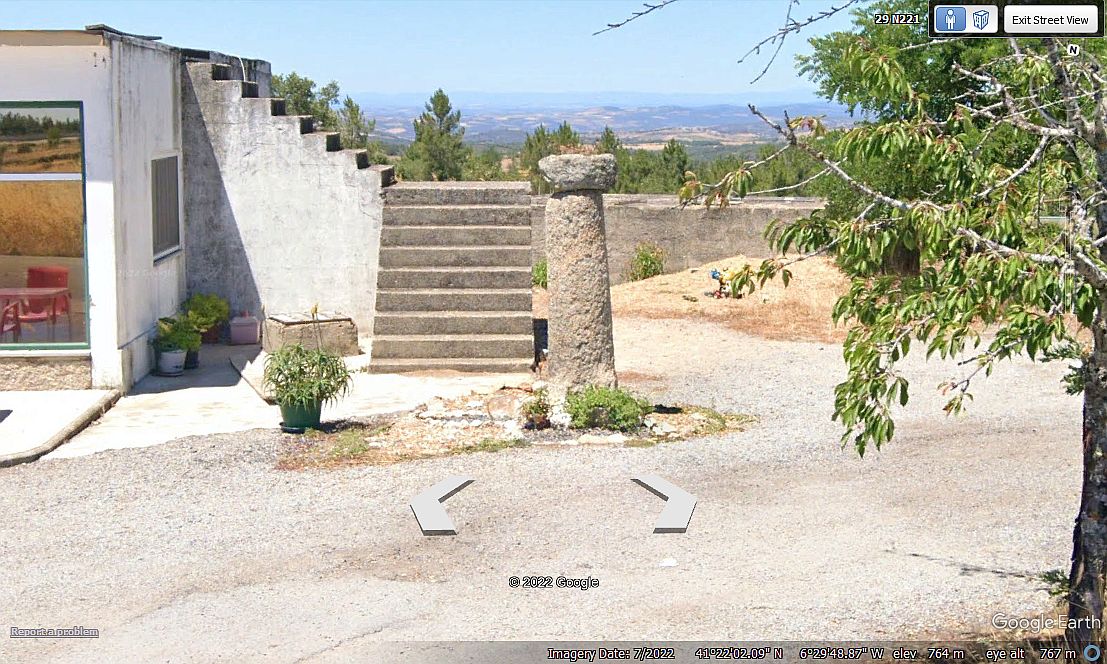
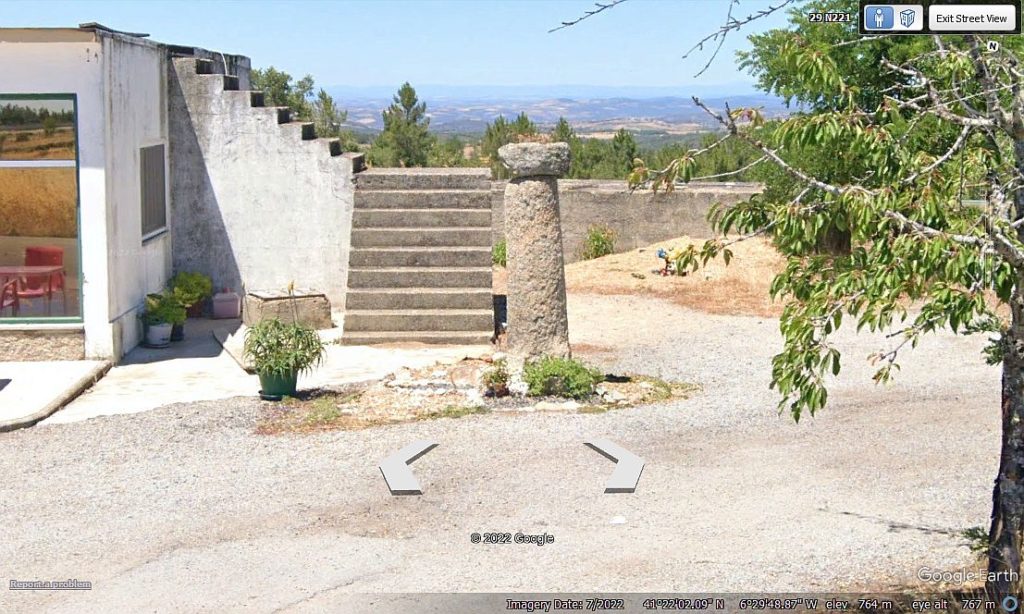
The Carril Mourisco was part of a large itinerary that started in Compleutica (station of the road Chaves-Astorga located in Figueruela de Arriba) that followed towards the Douro River by San Vitero, entering the current Portuguese territory by Cruz de Canda in Cicouro. From here its route is described by the Abbot of Baçal crossing the plateau Mirandês in the current municipalities of Miranda do Douro and Mogadouro. The doubts raised by various later authors on the chronology of the road has somewhat obscured its importance in the Roman road network, doubts that have since been dispelled by the recent identification of a milestone on the route of the “Carril Mourisco” which is currently at the halt of Urrós, near Café Ramiro, but which would have come from a corral in the parish of Brunhosinho.

Image of the Urrós milestone taken from Google Street View

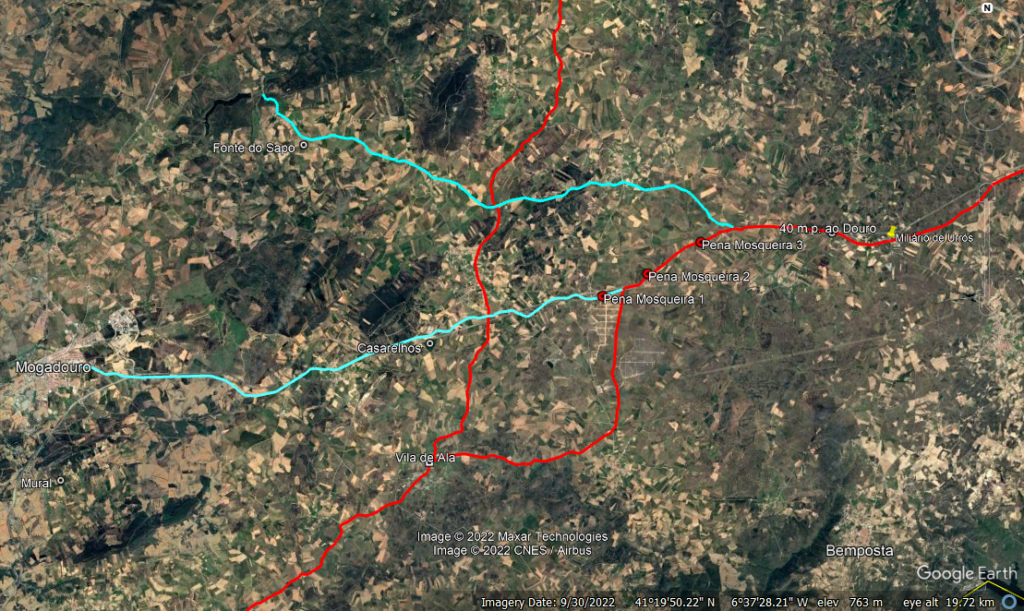
Although the cylinder is anepigraphic, we have no doubt that it is indeed a Roman milestone, given its quadrangular base and dimensions, (re)confirming the passage of the track along the railway line towards the Brunhosinho junction, a very important place, as from here the connection branches to Penas Roias and Mogadouro departed, while the Carril branched its course southwards towards Barca Dalva. This road junction is marked by several tumuli over the designation of megalithic set of Pena Mosqueira, showing the road character of these monuments, bringing back the origins of this route to the Late Neolithic (!).

According to our proposal, the milestone of Carril in the Urrós pass corresponds to mile 45, counted from Compleutica. However, as the milestone came from the vicinity of Brunhosinho, it is more likely that its original point of implantation was in the next mile which corresponds to the place where the track crosses the IC5 (41°22’7.42″N, 6°30’40.42″O). The distance from this place to the Douro is about 40 miles, so this could be the value indicated by the marker (as it is a usual value between stages of a journey), thus giving valuable information to travellers. From the following mile (39), the mentioned branch line departed towards Penas Roias, reaching the eighth mile next to the Roman site of Fonte do Sapo (next to the cemetery), which should correspond to a mutatio type road establishment. Returning to Carril, the next mile was reached next to the Pena Mosqueira mound 3, and the following mile was reached next to mound 2, considered the largest and most important of the four monuments of the Pena Mosqueira group. This place is very relevant because here was the point where the Mourisco Railway inflected its direction southwards towards Barca Dalva, and also because from here another branch line that linked it to Mogadouro, also located eight miles away.

Road junction at Pena Mosqueira, showing the Mourisco Railway crossing at Urrós and the IC5 crossroads, which could be the original site of the milestone, 40 m.p.m. of the Douro and 46 m.p.m. of Compleutica. The blue strokes correspond to the connection routes to Penas Roias and Mogadouro from the tumuli of Pena Mosqueira. In Vila de Ala the Carril converged with the north-south track that linked Babe to Vila de Ala

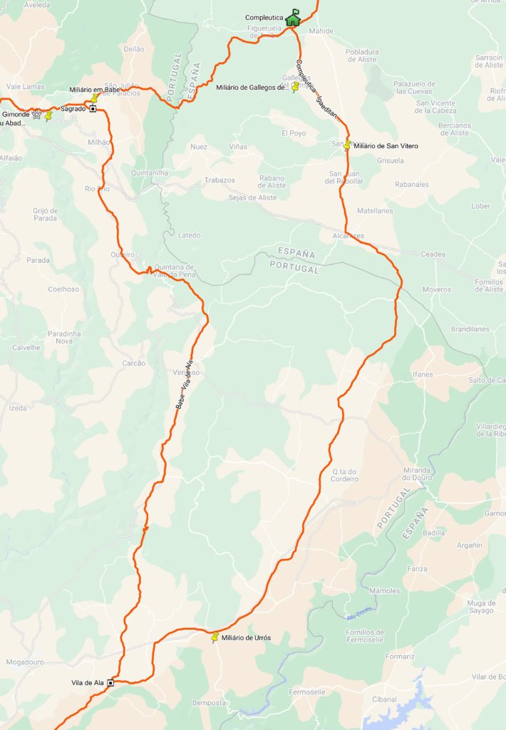
From Pena Mosqueira, the Carril followed northwest to the village of Tó, passing through the toponyms “Pinhal de Brunhozinho”, “Lagoa de Thó” and “Pontão de Thó”, as indicated by Celestino Beça (Alves, 1915, p. 7) and not Variz as previously proposed (LIMA et al., 2015, p. 58). At the northern entrance to this settlement there is a cross that marks the location of the milestone, i.e. 32 miles to the Douro. Note that it is eight miles from here to the milestone, suggesting that mutatio would exist here, a hypothesis greatly reinforced by the fact that this is the point where the ‘Carril’ converged on another important itinerary, also originating on the Chaves-Astorga route, but that left from the Babe road station (from the mutatio of the Sacred), following through Vimioso and the old Algoso bridge to Vila de Ala, also covering about 46 miles, curiously (or maybe not), the same value verified for the milestone from Brunhosinho to Compleutica. The route of this last track was finally identified in all its course that is now described here, being also included in the new version of the Routes Map (see 5.0).

Tracing of the two roads that converged in Vila de Ala towards the Douro (in viasromanas.pt/vr_map.html).

Links to the Itineraries:
Route from Compleutica to Barca Dalva (Carril Mourisco)
Route from Babe to Vila de Ala

Bibliograophy:
ALVES, Pe. Francisco Manuel (1915) – “Estudos arqueológicos do Major Celestino Beça – A estrada militar romana de Braga a Astorga por Bragança”. OAP Vol. XX, 74-106.
LEMOS, F. Sande (1993) – “Povoamento Romano de Trás-os-Montes Oriental”. Braga: University of Minho. Tese de Doutoramento.
LIMA, A.C. et all. (2015) – “O Carril Mourisco. O traçado romano de uma grande rota contemporânea”. In Côavisão, 17, 54-79.

O «Carril Mourisco» e outras vias

Tem havido um interesse crescente num caminho histórico habitualmente designado por Carril Mourisco que percorre o planalto Mirandês. Trata-se de uma via antiga percorrida pelos almocreves até aos inícios do século XX que foi registada em 1915 pelo Pe. Francisco Manuel Alves (mais conhecido por Abade de Baçal) com base em notas do Major Celestino Beça, aventando a possibilidade da estrada recuar ao período romano (Alves, 1915). Por consequência o caminho viria a ser assinalado como “Antiga Via Romana” no respectivo mapa militar, curiosamente a única vez que isso acontece em toda a série M888. Sande Lemos viria a publicar o trajecto (LEMOS 1993, p. 299) e mais recentemente foi feito o respectivo levantamento topográfico (LIMA et al., 2015). No entanto, subsistiam algumas dúvidas no seu trajecto após a passagem por Brunhosinho, dúvidas essas que finalmente conseguimos esclarecer, e que vieram clarificar a rede viária na região.

O Carril Mourisco integrava um grande itinerário com origem em Compleutica (estação da via Chaves-Astorga situada em Figueruela de Arriba) que seguia rumo ao Rio Douro por San Vitero, entrando no actual território português pela Cruz de Canda em Cicouro. A partir daqui o seu percurso é descrito pelo Abade de Baçal cruzando o planalto Mirandês nos actuais concelhos de Miranda do Douro e Mogadouro. As dúvidas colocadas por diversos autores posteriores sobre a cronologia da estrada tem de certa forma ocultado a sua importância na rede viária romana, dúvidas entretanto desfeitas pela recente identificação de um miliário no percurso do «Carril Mourisco» que está actualmente no apeadeiro de Urrós, junto do Café Ramiro, mas que teria vindo de um curral da freguesia de Brunhosinho.

Imagem do miliário de Urrós retirada do Google Street View

Apesar de anepígrafo, não temos dúvidas de que se trata efectivamente de um miliário romano atendendo à sua base quadrangular e dimensões, (re)confirmando a passagem da via ao longo da linha férrea rumo ao nó viário de Brunhosinho, local da maior importância pois daqui partiam ramais de ligação a Penas Roias e Mogadouro, enquanto o Carril inflectia o seu percurso para sul rumo a Barca Dalva. Este nó viário é assinalado por várias mamoas sobre a designação de conjunto megalítico da Pena Mosqueira, evidenciando o carácter viário destes monumentos, fazendo recuar as origens deste traçado ao Neolítico Final (!).

Segundo a nossa proposta, a marcação miliária do Carril no apeadeiro de Urrós corresponde à milha 45, contadas a partir de Compleutica. No entanto, como o miliário veio das proximidades de Brunhosinho, é mais provável que o seu ponto original de implantação fosse na milha seguinte que corresponde ao local onde a via cruza o IC5 (41°22’7.42″N, 6°30’40.42″O). Por sua vez, a distância deste local ao Douro é de cerca de 40 milhas pelo que este poderia ser o valor indicado pelo marco (dado ser um valor habitual entre etapas de uma jornada), dando assim preciosa informação aos viandantes. Da milha seguinte (39) partia o referido ramal para Penas Roias, atingindo a oitava milha junto do sítio romano da Fonte do Sapo (junto ao cemitério), que assim deverá corresponder a um estabelecimento viário tipo mutatio. Voltando ao Carril, a milha seguinte era atingida junto da mamoa 3 da Pena Mosqueira, e a seguinte milha era atingida junto da mamoa 2, considerada o maior e mais importante dos quatro monumentos do grupo da Pena Mosqueira. Este local é muito relevante porque aqui era o ponto onde o Carril Mourisco inflectia a sua direcção para sul rumo a Barca Dalva, e também porque daqui o partia um outro ramal que ligava a Mogadouro, também localizada a oito milhas.

Nó viário da Pena Mosqueira, mostrando a passagem do Carril Mourisco em Urrós e o local de cruzamento da IC5 que poderia ser o local original do miliário, 40 m.p. do Douro e 46 de Compleutica. Os traçados a azul correspondem aos ramais de ligação a Penas Roias e Mogadouro a partir das mamoas da Pena Mosqueira. Em Vila de Ala o Carril confluía com a via norte-sul que ligava Babe a Vila de Ala.

Da Pena Mosqueira, o Carril seguia a noroeste da aldeia de Tó, passando nos topónimos « Pinhal de Brunhozinho», «Lagoa de Thó» e «Pontão de Thó», tal como indicado por Celestino Beça (Alves, 1915, p. 7) e não por Variz como anteriormente proposto (LIMA et al., 2015, p. 58). Na entrada norte desta povoação existe um cruzeiro que assinala o local da marcação miliária, ou seja, 32 milhas ao Douro. Notar que são oito milhas daqui ao miliário, sugerindo que aqui existiria mutatio, hipótese muito reforçada pelo facto de este ser o ponto onde o «Carril» confluía noutro importante itinerário, também com origem na via Chaves-Astorga, mas que partia da estação viária de Babe (da mutatio do Sagrado), seguindo por Vimioso e pela velha Ponte de Algoso até Vila de Ala, percorrendo também cerca de 46 milhas, curiosamente (ou talvez não), o mesmo valor verificado para o miliário de Brunhosinho a Compleutica. O traçado desta última via foi finalmente identificado em todo o seu percurso que passa a estar descrito aqui, sendo também incluído na nova versão do Mapa de Vias (ver 5.0).

Traçado das duas vias que confluíam em Vila de Ala rumo ao Douro (in viasromanas.pt/vr_map.html).

Descrição dos Itinerários:
Via de Compleutica a Barca Dalva (Carril Mourisco)
Via de Babe a Vila de Ala

Bibliografia:
ALVES, Pe. Francisco Manuel (1915) – “Estudos arqueológicos do Major Celestino Beça – A estrada militar romana de Braga a Astorga por Bragança”. OAP Vol. XX, 74-106.
LEMOS, F. Sande (1993) – “Povoamento Romano de Trás-os-Montes Oriental”. Braga: Universidade do Minho. Tese de Doutoramento.
LIMA, A.C. et all. (2015) – “O Carril Mourisco. O traçado romano de uma grande rota contemporânea”. In Côavisão, 17, 54-79.