Monthly Archives: August 2019

The Roman bridge of Salamanca

(Originally published on September 13, 2013)

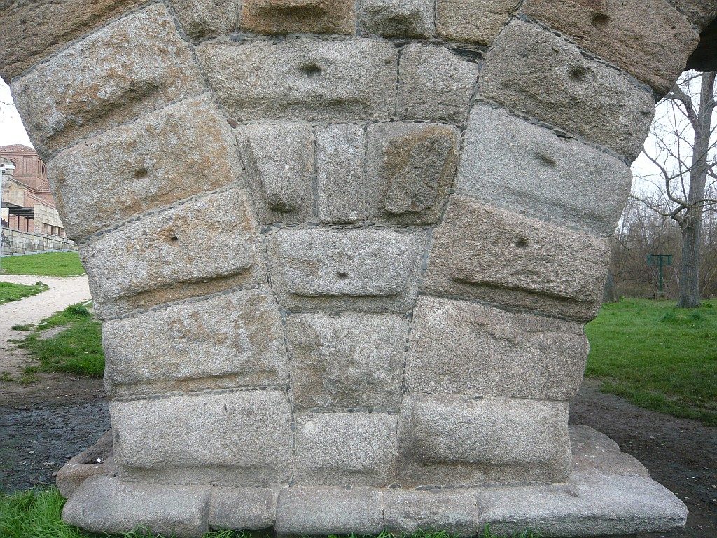
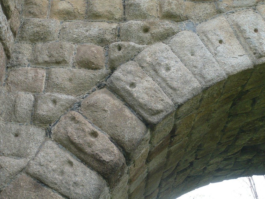
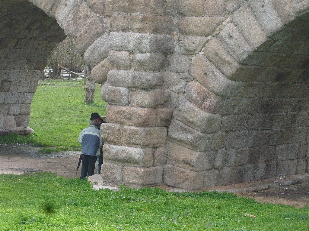
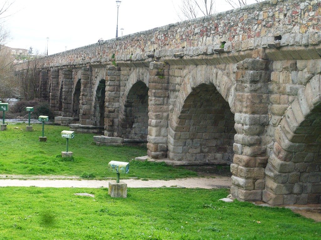
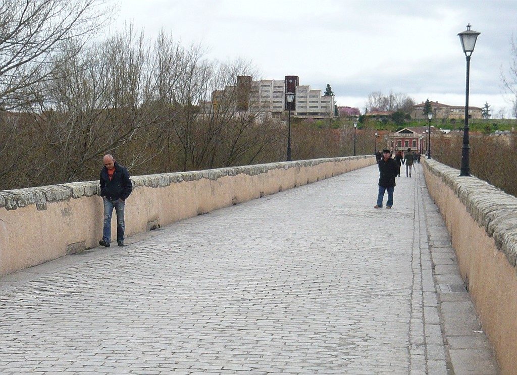
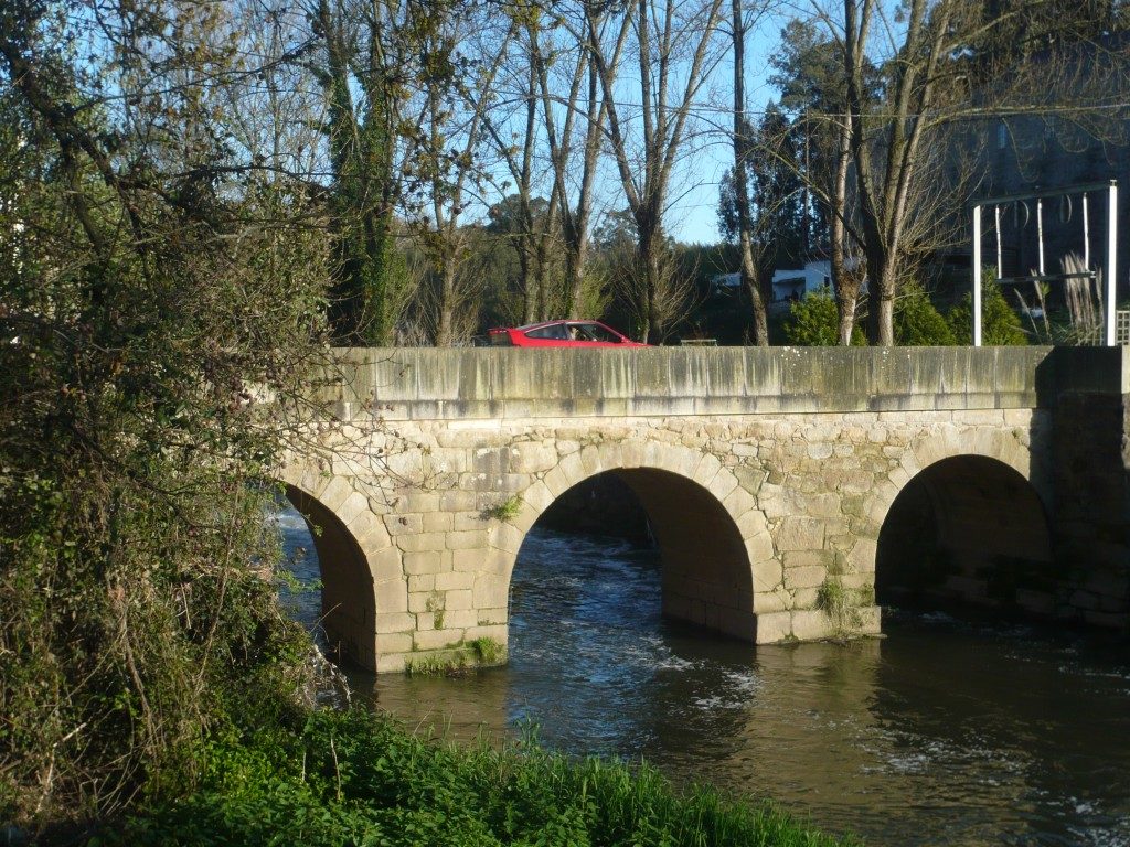
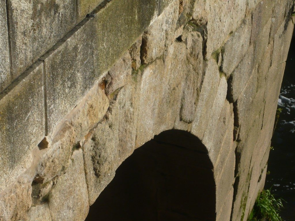
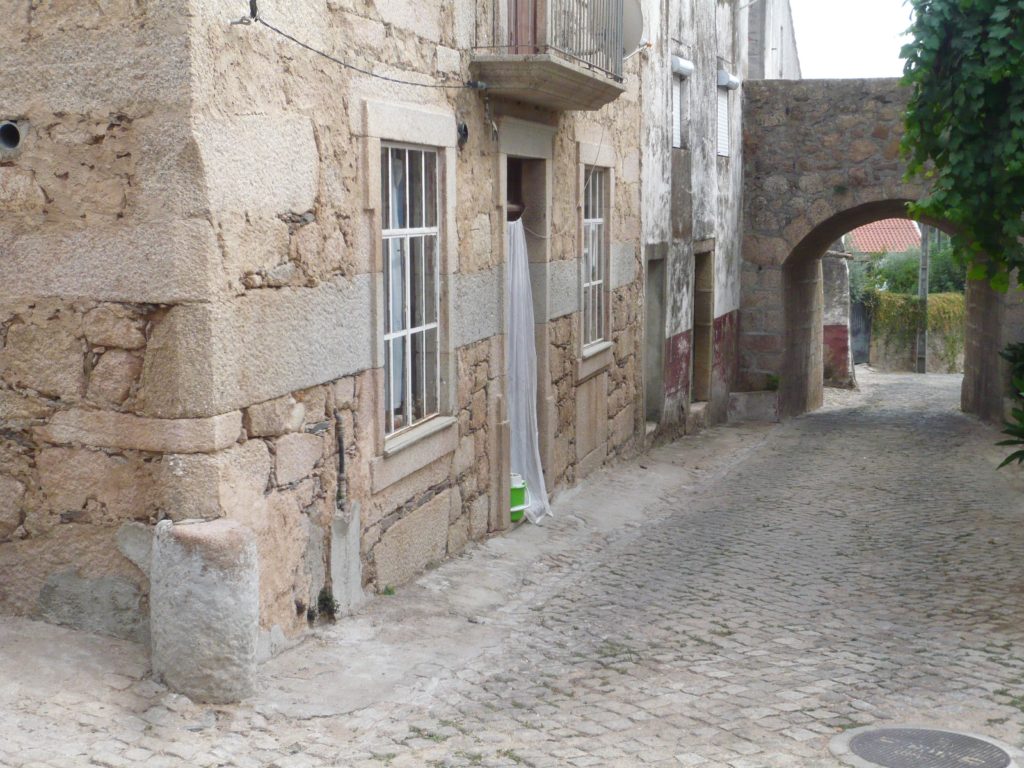
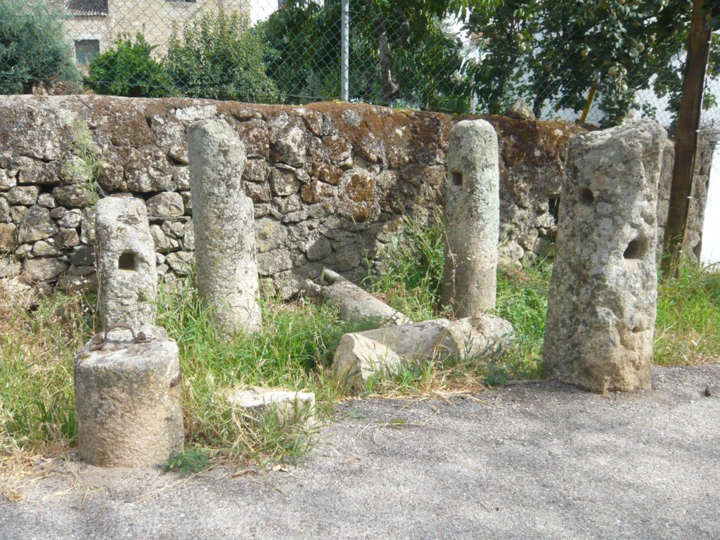
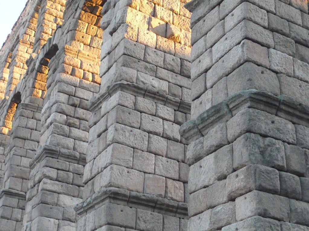
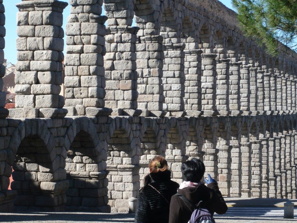
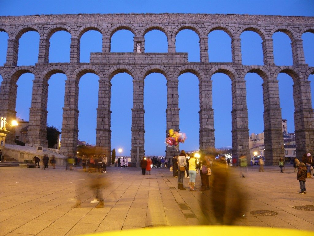
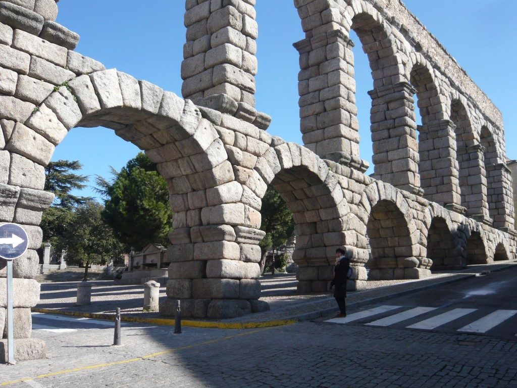
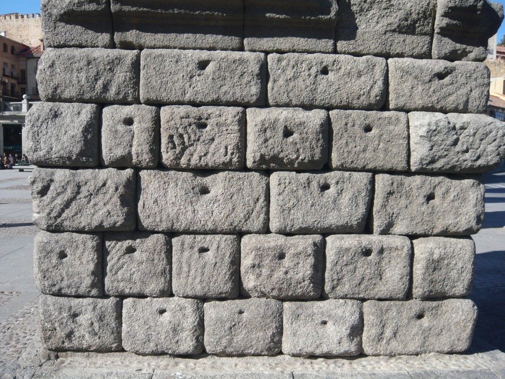
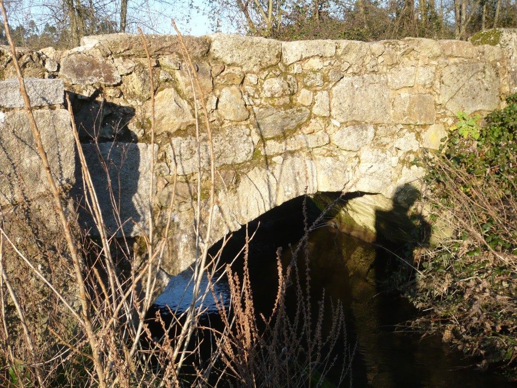
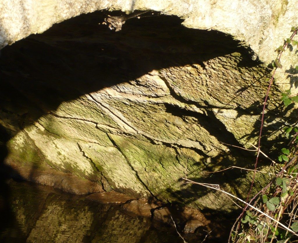
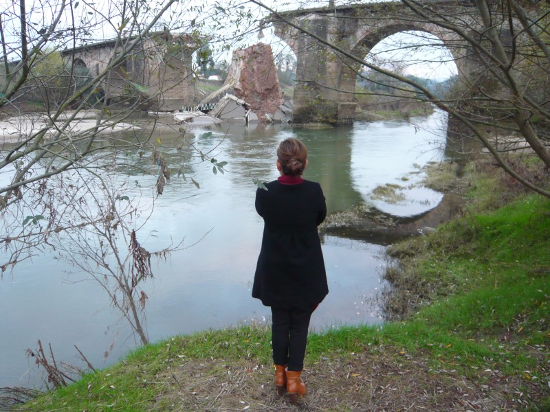
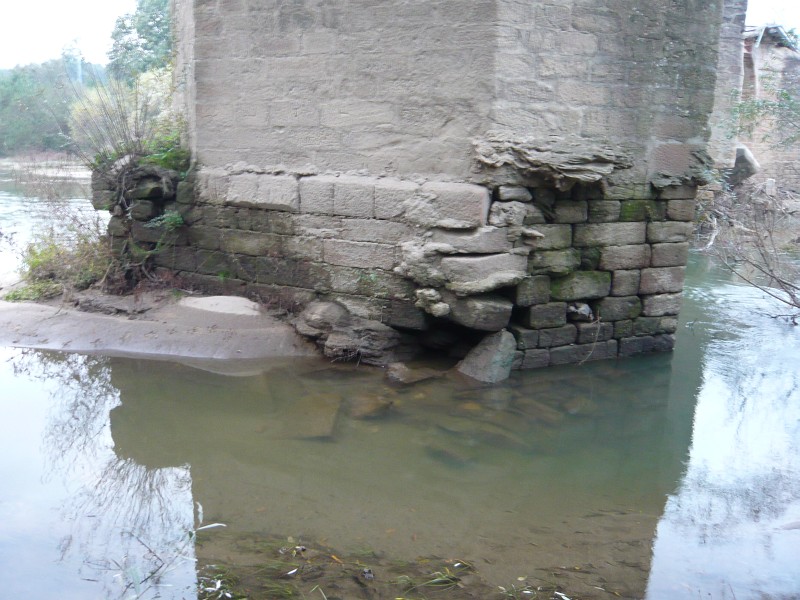
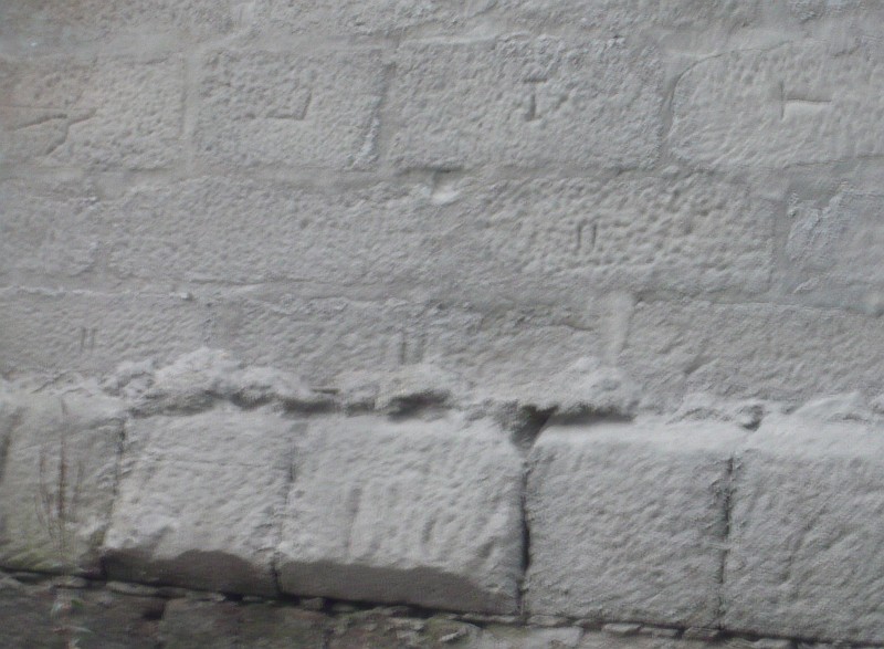
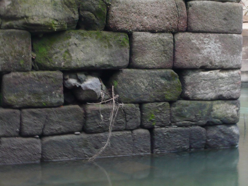
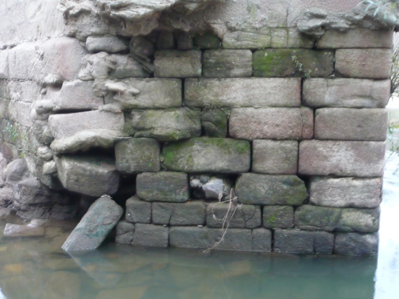
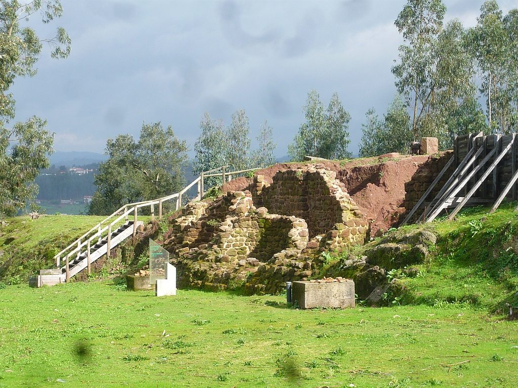
Some pictures recently taken of this monumental structure with 26 arches of which only the 15 date from Roman times. Salamanca’s Roman Bridge is one of the best preserved in the Iberian Peninsula. It was built in the first century AD and integrated the famous route between Emerita and Asturica, commonly known as «Via de la Plata». The monument highlights all the principles of Roman engineering for bridge construction, such as modularity; it’s 6 m wide allowing two-way traffic; holes on the borders allowed rainwater to flow out of the bridge. The ashlars have the typical forfex marks, demonstrating the use of mechanical tools for their positioning of the granite which by way was extracted 75 km from here (!), in the quarries of «Los Santos» close to Béjar.

The Roman bridge of Barreiros

(Originally published on September 12, 2013)

«Ponte de Barreiros», also known as «Ponte da Azenha» or «Ponte de Ronfes» is a bridge over the Leça River between Araújo and Maia, next to the National road EN13; This bridge was part of an old route linking Cale (Porto) to Limia (today Ponte de Lima) crossing the Cávado river in Barcelos, referred as “karraria antiqua” in medieval documents. The way is much older though with many pre-Roman settlements scattered along the way. It takes advantage of the natural corridors that exist between the rivers Douro and Lima and became a secondary road on the Roman network as no milestones were found on this route. The possible explanation for this could be in the fact that it misses the regional capital Bracara Augusta, the focal point for all main routes of the region back then. In medieval times became a major route to Santiago de Compostela and is still today the main way followed by pilgrims. Despite the rampant urbanisation It’s still possible to follow long sections the old way. The bridge suffered several reconstructions and repairs until reaching its present configuration, but the integration of some
cushioned ashlars in the arch staves on the right bank (visible in the photo) proves the reuse of materials from the previous Roman bridge. Coordinates:  41.224711,  -8.631817

Milestones at Vila Nova de Famalicão

(Originally published on September 12, 2013)

In the area of the city of Vila Nova de Famalicão there are two milestones related to the Via Bracara AugustaCale that passes close. One is now serving as decorative element at the city park in the former «Quinta da Devesa» and the following letter could still be read:
[…] CAES
[…] AELIO
[…] RIANO
[…] N? NO
[…] RACAR (A)
[…] III
(source)

Although very truncated, it is still possible to read the reference to Braga and the mileage count on the two last lines. This numeral suggests that it could indicate the 13th mile since Braga which is attained next to the Romanesque Church of Santiago de Antas in Famalicão; Coordinates: 41.409888, -8.507708

Another possible milestone is now outside the private chapel of the family house of «Quinta do Vinhal» close to the train station of Famalicão and it is visible from the road. Coordinates: 41.412486, -8.527252

Finally, the third picture refers to a possible fragment of milestone that is currently integrated into the western wall of the Cambonian Seminary next to the Church of Santiago das Antas; Rodriguez Colmenero proposed that this milestone is the same mentioned by Contador de Argote serving as the base of the cross that existed here, and dedicated to Emperor Caracalla (CIL II 4741). Coordinates: 41.402250, -8.510186

The engraved cross at «Lugar das Marcas»

(Originally published on January 21, 2013)

This impressive cross engraved in a boulder in the late 11th century is located on the left bank of Ave river and about 300 m from Lagoncinha Bridge. It is related to the demarcation of a large property (“Couto”) belonging to the Monastery of Santo Tirso. It could be related to this crossing point of the Ave river in Roman times since the Lagoncinha Bridge it’s a medieval construction with no signs of any Roman materials. There’s also a reference to an “old bridge” here in a document of the Monastery establishing the boundaries of the “Couto”. Coordinates: 41.348666, -8.515968

Bibliography: Barroca, Mário Jorge (2006). “A Cruz do Lugar das Marcas (Lousado, Vila Nova de Famalicão) e o Couto do Mosteiro de Santo Tirso”. FLUP

Milestones at Segura

(Originally published on November 15, 2013)

In the village of Segura (Idanha-a-Nova) there are several columns scattered around the village that may be milestones of the Roman road that passed through here to Merida. Within the village there are two small columns and at least one of them (near the South Gate) has the typical dimensions of these monuments. Leaving the village to the north via the Roman road that passes at the base of the Calvary hill, there are several columns at the side of the road and some tens of meters later another set of these columns showing signs of reuse as they present an orifice at the top and signs of being re-shaped; at least some of them are certainly milestones since they have the typical quadrangular base, an indicative feature that these columns were meant to be buried. These milestones are still unpublished so I can’t say anything more about their provenance , their reuse or why were they gathered here. Probably they will disappear soon due to their state of neglect. For when the appreciation of this important monuments?

Possible milestone lying down on the side of the road (note the square-shape base)

vide route here – http://viasromanas.pt/#idanha_merida

Roman road in «Ammaia»

(Originally published on November, 2012)

A stretch of the road in Carris. Vestiges of the pavement.

One of the Roman roads that departed from the Roman city of Ammaia (S. Salvador de Aramenha, Marvão) crossed the Roman Bridge of the Madalena and went uphill along this stretch of the road in a site called «Carris». This route continues for a few kilometres until it meets the modern road EN359, perhaps with continuation towards Évora through Portalegre. Coordinates: 39.354269,-7.401371

vide route here – http://viasromanas.pt/#ammaia_evora

Segovia aqueduct

(Originally published on March 16, 2012)

Pictures I took of the famous Segovia aqueduct, one of the great works of Roman engineering that has survived to this day. Note the absence of mortars between blocks and the markings of forfex confirming the use of machinery for lifting and positioning the various building elements. Another Roman construction that has been challenges the passage of time for centuries.

Roçadas bridge

(Originally published on March 16, 2012)

This bridge is located in the place of Roçadas in Argoncilhe (Santa Maria da Feira). It was probably on the route connecting Cale (Porto) to Vissaium (Viseu). its present form is a rough construction not that all, but given its integration in this ancient path, it origins could be much older. An old section of the road can still be seem next to the bridge. Coordinates: 41.025388, -8.520372

vide route here – http://viasromanas.pt/#porto_viseu

Milestone in the Chapel of St. Brissos

(Originally published on January 6, 2012)

Picture of a milestone that is today next to Chapel of St. Brissos (Santiago do Escoural, Montemor-o-Novo). It is likely that this milestone was displaced from the Roman road between Alcácer do Sal and Évora on the route to Mérida, which ran a little further south but it could be signalling another still unknown route. Photo kindly sent by Paulo Manços. Coordinates: 38.526076,-8.102848

The ancient bridge over the Vouga river

(Originally published on December 5, 2011)

The fall of the Vouga Bridge on November 12 2011 was not a surprise due to the advanced state of degradation of the bridge’s pillars. What is surprising is the willingness of the municipality to demolish the bridge (!), a decision that I hope will be overturned because this bridge has a great patrimonial value that cannot be obliterated. The current bridge is the result of successive repairs, the last one was its enlargement in the 1930s to adapt it to modern traffic. We know that its construction was ordered by D. João III in 1529 and that it was repaired in 1713 by order of D. João V given to the bridge its current configuration. In fact the current bridge was built on the structure of an earlier medieval bridge from which the pillars and arches are still visible, as can be seen in the picture above. Coordinates: 40.640735,-8.465931

The existence here of an early Roman construction is plausible because this was the crossing point of the main road connecting Bracara Augusta (Braga) to Olisipo (Lisbon). In fact, on a hilltop overlooking this passage there’s an important archaeological site known as «Cabeço do Vouga» where we can see a strong Roman construction built over a pre-Roman settlement. This could be the location of Talabriga, a road station mentioned in Anthony’s Itinerary. Coordinates: 40.637037, -8.463959